|
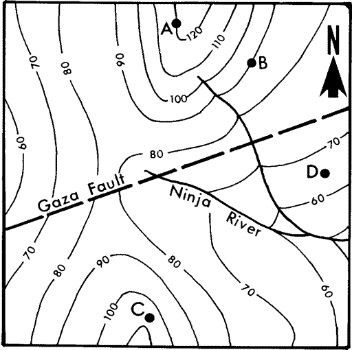
The terrain is hilly, the result of erosion over the last 10,000
years. A team of geologists has studied the bedrock in the area.
They have learned that:
1. A horizontal layer of pure sulfur (D = 2.1 g/cm3) is exposed
locally in the map area.
2. The layer is 15 m thick, and the top of the layer lies 25 m below
point 'A'.
3. The Gaza Fault crosses the map area. The Gaza Fault is a vertical
fracture plane in the bedrock.
4. Movement along the fault plane has uplifted the bedrock northwest
of the fault exactly 5 m relative to the southeast side.
|